
Island List


Ko Yo - 10.8613907,99.4857157 - https://goo.gl/maps/NTPnsEaDMxo

Ko Waing - 10.853557, 99.485543 - https://goo.gl/maps/zN2Rfeu8c662


Ko Kai - 10.7013267, 99.4096282 - https://goo.gl/maps/4J81Pjq7MFy
Uninhabited. Sandy beach on western side. Covered in trees and bushes.

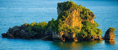
Ko Chorakhe - 10.5574947, 99.3791274 - https://goo.gl/maps/1Mk57iBoQEk 🔱
Uninhabited. Sandy beach on all sides. Covered in trees and bushes.


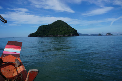
Ko Ngam Yai - 10.4944002, 99.4187252 - https://goo.gl/maps/i4BDdvbiD742
Good dive sites - Our Visit 🔱

Good dive sites - Our Visit 🔱

Ko Thalu - 10.465533, 99.359680 - https://goo.gl/maps/MUTZfZ9gfZB2
Small rocky island with a through cave. Good diving🔱

Ko Muttaphon - 10.4481699, 99.2535531 - https://goo.gl/maps/ZGAi3SL2nB62
 Ko Samet - 10.4401918, 99.2964202 - https://goo.gl/maps/AxVARQ5q2LG2

Ko Sak - 10.425289, 99.315809 - https://goo.gl/maps/Xu4rwjKf3VR2
A radio station operated by Department of Hydrology is on the Island.
Possible to walk to the island on a sand bar at low tide. Our Visit


Ko Sak - 10.425289, 99.315809 - https://goo.gl/maps/Xu4rwjKf3VR2

Ko Mattra - 10.3977928, 99.3477003 - https://goo.gl/maps/aAmgkcrWND92 🔱
 Ko Maphrao - 10.3919652, 99.2936218 - https://goo.gl/maps/qeUeXpKdsq72

Fishermen live on the northern end of the island. Abandoned huts.
Sandy beach on western side. Covered in trees and bushes - Our Visit


Ko I Raet - 10.3765267, 99.3221932 - https://goo.gl/maps/aYfZ6xLL8Ev

Ko Lawa - 10.3637422, 99.3095856 - https://goo.gl/maps/vGT5VZgQXNu 🔱
 Ko Ka - 10.3481509, 99.2940569 - https://goo.gl/maps/v76Y3Tq9L7u
Ko Thonglang - 10.3236795, 99.2810223 - https://goo.gl/maps/3MwfTAHZ2pq
Ko Rang Ka Chio (Wang Ka Chio) - 10.3187879,99.2997491 - https://goo.gl/maps/upRu5fPSb5D2 🔱
 Ko Klaep - 10.2964223,99.2465166 - https://goo.gl/maps/Mm1PfA5Do7q
Ko Bat - 10.2908577,99.2413297 - https://goo.gl/maps/d1HoidzU9vk
Ko Yung - 10.271666, 99.2161015 - https://goo.gl/maps/dNxctgWSqX82


 Ko Kula - 10.2552978, 99.2573413 - https://goo.gl/maps/YZXfzEzk45k
 Ko Kra - 10.2470465, 99.248617 - https://goo.gl/maps/cFFdNF4e2qC2
 Ko Mat Wai Yai - 10.2001734, 99.2484054 - https://goo.gl/maps/GHgJz9yvcVk
 Ko Thong Kaeo - 10.196096, 99.221190 - https://goo.gl/maps/W7saHRV7Pnw

Uninhabited. Covered in trees and bushes. Sandy beach on western side.

Ko Thonglang - 10.3236795, 99.2810223 - https://goo.gl/maps/3MwfTAHZ2pq
Ko Rang Ka Chio (Wang Ka Chio) - 10.3187879,99.2997491 - https://goo.gl/maps/upRu5fPSb5D2 🔱
Uninhabited except for some bird nest collector/fishermen huts.
Sandy beach on western side. Covered in trees and bushes.

Ko Bat - 10.2908577,99.2413297 - https://goo.gl/maps/d1HoidzU9vk
Ko Yung - 10.271666, 99.2161015 - https://goo.gl/maps/dNxctgWSqX82
Uninhabited except for some bird nest collector huts.
Covered in trees and bushes. No easy access - Our Visit

Ko Nu - 10.2553181, 99.2244029 - https://goo.gl/maps/TDawQfE4Pjw
Uninhabited. Covered in trees and bushes. No easy access - Our Visit

Ko Maeo - 10.2477628,99.2226145 - https://goo.gl/maps/r6ZsHAPz6N22
Uninhabited. Covered in trees and bushes. No easy access - Our Visit

Resort on the island operated by Mo Koh Chumphon National Park.
Sandy beach on western side. Covered in trees and bushes. - Our Visit

Uninhabited. Covered in trees and bushes. No easy access.
Ko Raet - 10.2218179, 99.2421213 - https://goo.gl/maps/J4iPjsFwTkx
Uninhabited. Covered in trees and bushes. No easy access.
Ko Mat Wai Noi - 10.2076813, 99.2485917 - https://goo.gl/maps/3HLBmbo7JFS2
Uninhabited. Covered in trees and bushes. No easy access - Our Visit

Uninhabited except for some bird nest collector huts. Nice rock formations.
Sandy beach on western side. Covered in trees and bushes. - Our Visit

Uninhabited. Covered in trees and bushes. No easy access - Our Visit

Ko Sup - 10.164724, 99.176243 - https://goo.gl/maps/kLrj1mSJLbT2
Uninhabited. Covered in trees and bushes. No easy access. Close to shore.

Ko Khang Suea - 10.1538832, 99.2171173 - https://goo.gl/maps/B22JnVmNw5s
Fishermen live on the northern end of the island.
Sandy beach on western side. Covered in trees and bushes. - Our Visit


Ko Rang Ha - 10.149833, 99.204059 - https://goo.gl/maps/uEidjvnH5iy
Uninhabited except for some bird nest collector huts
Covered in trees and bushes. No easy access. - Our Visit


 Ko Khram - 10.0711804, 99.1847286 - https://goo.gl/maps/EufD1HEa7un


Ko Maphrao - 10.143085, 99.1774583 - https://goo.gl/maps/AXWesNFVzEx
Fishermen live on the northern end of the island.
Sandy beach on western and southern side. Covered in trees and bushes. - Our Visit
Ko Yo - 10.1316318, 99.1623413 - https://goo.gl/maps/Z7ZZE8m3xJF2
Uninhabited except for some abandoned fishing huts
Sandy beach on western side. Covered in trees and bushes. - Our Visit
Ko Muk - 10.1305606, 99.1642891 - https://goo.gl/maps/aiYXHCQtQBB2
Uninhabited. Covered in trees and bushes. No easy access. - Our Visit

Ko Rang Banthat - 10.117026, 99.215637 - https://goo.gl/maps/SRypAVGkhdz
Ko Khi Nok - 10.118483, 99.186371 - https://goo.gl/maps/EaNgWuf4qqs
Ko Khi Nok - 10.118483, 99.186371 - https://goo.gl/maps/EaNgWuf4qqs
Small rock island with a white automatice lighthouse.

Uninhabited. Covered in trees and bushes. No easy access.

Ko Phitak - 10.0516323, 99.1867246 - https://goo.gl/maps/1h3Z9gduQEx

Large number of Home Stay's on the western side of the island.
Close to shore. Covered in trees and bushes. - Our Visit

🔱 Good snorkeling and diving.
Comments
Post a Comment